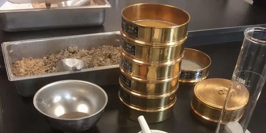
The stack of 8-inch brass sieves hits the Ro-Tap shaker, and within 15 minutes the mechanical orbit and hammer tap start sorting the 500-gram sample into fractions from 4.75 mm down to 75 microns. But that is only half the picture for Richmond Hill soils. Once the wash passes through the No. 200 sieve, the minus-75-micron suspension goes straight into a 1000 mL graduated cylinder where a 152H hydrometer measures density at timed intervals over 24 hours, because the silts and clays that dominate the glacial till and glaciolacustrine deposits north of Highway 7 simply cannot be characterized by sieving alone. The combined ASTM D422 and ASTM D7928 run — sieve stack plus hydrometer sedimentation — is the standard we run daily for grading contractors, geotechnical consultants, and stormwater engineers working in York Region. In a borough where Oak Ridges Moraine geology layers sand lenses directly above impervious clayey silt, the full particle-size distribution curve is not optional; it is the foundation of every percolation test, infiltration trench design, and fill compaction specification that crosses our Richmond Hill lab bench.
On the Oak Ridges Moraine, a 6% shift in fines content can change the drainage class of a fill material — the hydrometer captures what the sieves miss.